
PANORAMA | All | Use Now
What is this?
I build this tool because i want to extract some Google Street View as base panoramic scenery for my "Phoenix RC Simulator" projects which you can see sample of my project at my website: https://www.supermotoxl.com/projects-articles/tec-dec-site-models/public-civic-center-bintulu-phoenix-r-c-simulator.html. Previous way of extracting this scenery was cumbersome; i have to use multiple amount of tools just to extract the Google Street View, compile to panorama format, adjust its graphics and then slice to Cubemap format (tiles) before it can be use into my PHOENIX RC BUILDER tools. But with this new extraction, editing and pano/cubemap exporting feature 'all in one' i can now have a single application/tools to do that and make my RC simulator project an easy task. This also applicable to other user especially for use in game or visual/graphics development.
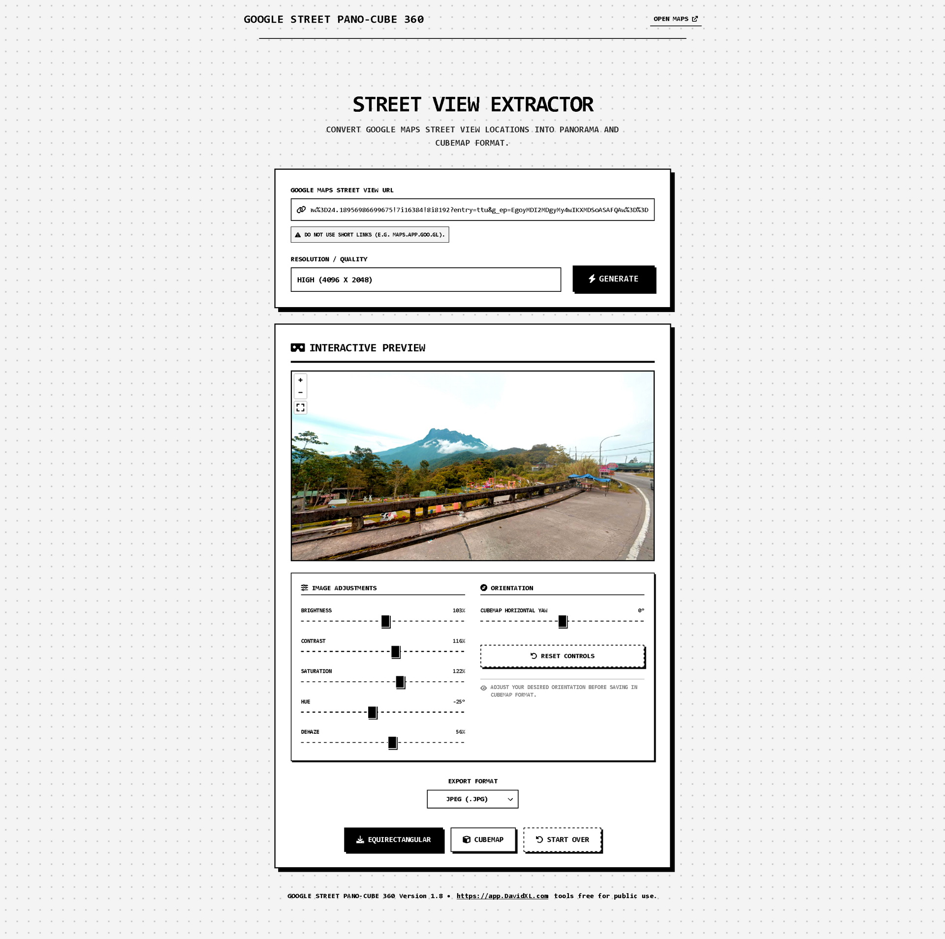
To sum up this is a "Google Street Pano-Cube 360" a client-side web application designed to extract and convert Google Maps Street View locations into raw, high-resolution 360-degree panorama files. Whether you are a 3D artist, game developer, researcher, or architectural visualizer, this tool allows you to pull spherical environmental data directly from the browser without requiring complex software or server-side processing.
Updates and bug fix log:
18/9/2026 - Increase extraction resolution to 16384 X 8192 (MAX) resolution.
What can it do?
This tool is packed with features to ensure your extracted Google Street View environments are perfectly formatted for your projects:
- Stitch together multi-tile Street View data at up to MAX 16384 X 8192 pixel resolution for crisp, immersive environments.
- Dual Export Modes: Download standard 2:1 Equirectangular panoramas (ideal for VR and HDRI setups) or automatically process the image into a 6-face Cubemap (
.zippackage) for immediate use in game engines like Unity, Unreal Engine or in my case 'special' use is for PHOENIX RC Simulator which you can find here. SupermotoXL Tec-Dec/Site Models. - Interactive Preview: Live-view your generated panorama in a fully responsive 3D viewport before you download.
- Live Image Adjustments: Built-in editing suite allows you to tweak Brightness, Contrast, Saturation, Hue, and a specialized Dehaze function to cut through atmospheric fog—all synced live to the viewport.
- Customizable Cubemap Orientation: Use the Yaw Offset slider to manually rotate the environment, determining exactly what appears on the "Front" face of your exported cubemap.
- Support multiple formats: Export in JPEG, PNG, WEBP, or uncompressed BMP.
How to use it
Step 1: Get your Location Open Google Maps, navigate to your desired location, and drop the yellow "Pegman" onto the street to enter Street View. Position the camera where you want it.
Step 2: Copy the URL Copy the entire URL from your browser's address bar. (Note: Do not use the "Share" button to get a short link like maps.app.goo.gl. The app requires the full, expanded URL containing the coordinates and panorama ID).
Step 3: Generate the Image Paste the URL into the "Google Maps Street View URL" input field in the app. Select your desired Quality/Resolution, and click GENERATE. The app will map and stitch the grid in real-time.
Step 4: Preview and Enhance Once generated, explore your panorama in the Interactive Preview viewport. Use the sliders under "Image Adjustments" to correct lighting, colors, or haze. If you are downloading a Cubemap, use the "Orientation" slider to rotate your front-facing view.
Step 5: Export and Save Select your preferred image format from the dropdown menu. Click EQUIRECTANGULAR to download the flat spherical map, or CUBEMAP to generate and download a .zip file containing the six individual directional faces.